Abigail Reynolds


> Artist's Statement <

> Curriculum Vitae <


www.abigailreynolds.com
abigailr@onetel.com


Progress:

City breaks
(Nov. 2004)


City breaks
(Jan. 2005)


City breaks
(Mar. 2005)


City breaks statement
Abigail Reynolds, Nov. 2004


CITY + MAPPING + STATISTICS = MOUNT FEAR

The terrain of Mount Fear is generated by data sets relating to the frequency and position of urban crimes. Precise statistics provided by the police are digitally plotted and rendered by a 3D modelling programme. Each individual incident adds to the height of the model, forming a mountainous terrain.
All Mount Fear models are built on the same principals. The imaginative fantasy space seemingly proposed by the object/image is subverted by the hard facts and logic of the criteria that shape it. The object does not describe an ideal other-worldly space separated from lived reality, but conversely describes in relentless detail the actuality of life on the city streets.

WORDS + MAPPING + TIME = FROZEN SEA

Using information contained in the Oxford English Dictionary, the furniture in a study has been rearranged to map out the relationships contained in the word ‘check’ In The Frozen Sea, the audience sees a working study. Each object in the study has been assigned a word. Large objects are older words, small objects are newer words. The correlations of object volume and word age are worked out on papers, collages and blackboards all over the study. Objects are marked up with the words they denote in the collaged elements only.
Objects are arranged according to the following rules in both the collages and the study: An etymological connection between two terms means they are stacked vertically. A semantic or cognitive connection means the objects are placed beside one another. In this work, the study is used as a place to think and also as material to work out the relationships between words. Once a word is mapped, the furniture is re-assigned to work out a new word group.

CITY + MAPPING + TIME = CITY BREAKS

I have been looking at ways of mapping change and I usually work from my experience of immersing myself for a long time in a process and place - like the way I feel about risk and my London environment or the Dictionary department of Oxford University.
Doing this kind of research takes a very long time. It's the point really of the work.
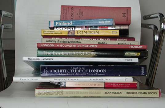
With City Breaks then, I have been wondering how to register the temperature of a foreign city and then find a way to represent that QUICKLY. It's a tall order. So I started to think about the opposite - the cliched view of a city - the shots that all photographers take, whether professional or amateur. And I also started to think about the universal now and how you can see through time if you have different photos - and that's where I am now. I have now amassed a huge number of secondhand books of London views. Now I just need to find lots of Helsinki books, so that I can see where there might be crossovers.